Tool List
Current filter applied: GRAPHICAL tools only (remove filter)

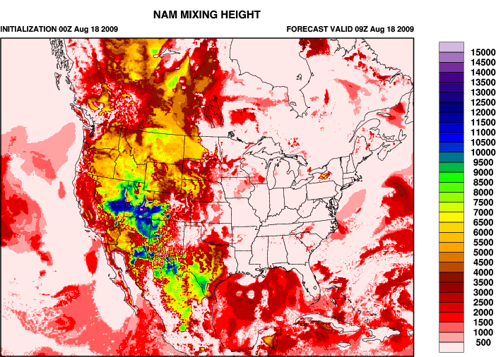
Smoke Guidance Regional Maps

maps of atmospheric conditions and predicted smoke concentrations
produced by: National FCAMMS

Predictions of ground smoke concentrations and atmospheric conditions affecting smoke using weather model data and smoke dispersion models. National scope.

  • Ground Smoke Concentrations (PM2.5)
  • Mixing Height
  • Transport Winds
  • Ventilation Index
  • National Scope
  • 3 & 7 day forecasts
  • Uses National Weather Service NAM and GFS weather predictions
  • 12km resolution (3-day) / 30-km resolution (7-day)
ATTRIBUTES
INSTANT ACCESS
EASY TO USE
■ REGIONAL
graphics
☼ ➳ ATMOSPHERIC CONDITIONS
SMOKE
CONCENTRATIONS

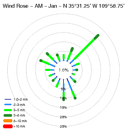
Diurnal Surface Wind Pattern Analysis

RAWS based day and night windroses for nearest site
produced by: CEFA/DRI

Analysis of historic RAWS data for the nearest site to your fire location showing day and night patterns that determine potential night-time drainage of smoke.

  • Separate day and night diagrams
  • National Scope
  • Point Location Data
  • Uses RAWS data
ATTRIBUTES
INSTANT ACCESS
EASY TO USE
๏ LOCALIZED
graphics
☼ ➳ ATMOSPHERIC CONDITIONS

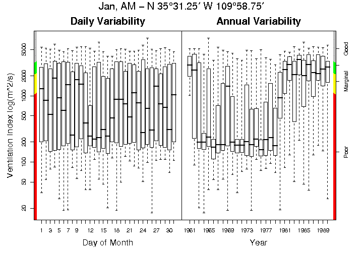
Climatological Venitilation Index Point Statistics

modeled mixing height, winds, and ventiliation index climatology on super-high-resolution grid
produced by: Ventilation Climate Information System (VCIS) by USFS AirFire

Analysis of historic model interpolated data showing day and night wind patterns, mixing heights, and ventilation index. Can be used in determining the potential for night-time drainage of smoke.

  • Surface Winds
  • Mixing Height
  • Ventilation Index
  • National Coverage
  • Localized (5-km grid) Information
  • Day and night statistics
ATTRIBUTES
INSTANT ACCESS
๏ LOCALIZED
graphics
☼ ➳ ATMOSPHERIC CONDITIONS

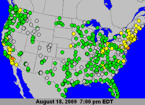
Current Air Quality Conditions Map

collected air quality monitoring information interpolated into maps
produced by: EPA AirNow Program
Maps of the current state of air quality at both national and regional scale. Maps are producted by interpolating real-time telemetered monitor data.
  • Current PM2.5 concentrations
  • Current Ozone concentrations
  • National Coverage
  • Based on monitoring data from state and federal in-situ monitors
ATTRIBUTES
INSTANT ACCESS
EASY TO USE
■ REGIONAL
graphics
SMOKE
CONCENTRATIONS

Fire Information and Smoke Trajectories

current fire information and interactive, while-you-wait trajectories
produced by: SMARTFIRE system from STI and USFS AirFire
Fire information collected from satellites and ground reports coupled with the ability to generate trajectories on-the-fly. Trajectories are done using the HYSPLIT model and National Weather Service weather forecasts.
  • Fire Information
  • Smoke Trajectories
  • National Coverage
  • Interactive website - click to create trajectories
  • Customizable - change layers and region
  • Uses National Weather Service weather forecast
ATTRIBUTES
INSTANT ACCESS
EASY TO USE
■ REGIONAL
graphics
↹ INTERACTIVE
☼ ➳ ATMOSPHERIC CONDITIONS

Customized Fuels, Consumption, and Smoke Modeling

fully configurable while-you-wait modeling that allows comparison between models
produced by: BlueSky Playground system by USFS AirFire and STI
Interactive website that allows the user to choose their fuel loadings, fire consumption model, and more. Outputs are viewable at every step and can be changed before continuing. Model runs done while-you-wait, including smoke impacts. Currently single fire only.
  • Fuel Loadings
  • Fire Consumption
  • Fire Emissions
  • Plume Rise
  • Smoke Concentrations
  • National Coverage
  • Customizable - input your fire information, change any modeled values
  • Interactive - view results while you wait
  • Uses a variety of meteorological data including National Weather Service forecasts
  • Fuels and consumption done on 1-km grid / smoke dispersion on meteorological grids (4-, 12-, and 30-km depending on source)
ATTRIBUTES
INSTANT ACCESS
EASY TO USE
๏ LOCALIZED
■ REGIONAL
text
graphics
↹ INTERACTIVE
SMOKE
CONCENTRATIONS
CREATED IN PARTNERSHIP WITH
wfdsslogo